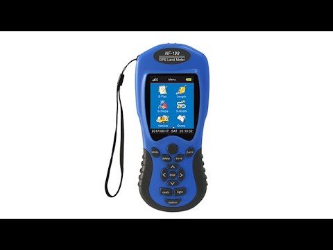
VR

Introducing our cutting-edge GPS land meter product – the perfect to

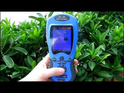
Our GPS land meter is incredibly user-friendly and easy to operate, making it the ideal tool for professionals and amateurs alike. With its high-precision GPS receiver and advanced mapping software, you can easily measure land area, distance, and perimeter with unparalleled accuracy. You can also create detailed maps of your land, complete with topographical features, boundaries, and other important data.


Whether you're surveying large tracts of land, mapping out a new construction project, or simply exploring the outdoors, our GPS land meter is the perfect tool for the job. So why wait? Try our GPS land meter today and experience the power of precision measurement and mapping!


Send your inquiry

Choose a different language
English
Magyar
Ελληνικά
한국어
Türkçe
русский
italiano
Español
Português
Polski
français
Deutsch
日本語
Nederlands
Tiếng Việt
ภาษาไทย
Latin
العربية
简体中文
繁體中文
Afrikaans
አማርኛ
Azərbaycan
Беларуская
български
বাংলা
Bosanski
Català
Sugbuanon
Corsu
čeština
Cymraeg
dansk
Esperanto
Eesti
Euskara
فارسی
Suomi
Frysk
Gaeilgenah
Gàidhlig
Galego
ગુજરાતી
Hausa
Ōlelo Hawaiʻi
हिन्दी
Hmong
Hrvatski
Kreyòl ayisyen
հայերեն
bahasa Indonesia
Igbo
Íslenska
עִברִית
Basa Jawa
ქართველი
Қазақ Тілі
ខ្មែរ
ಕನ್ನಡ
Kurdî (Kurmancî)
Кыргызча
Lëtzebuergesch
ລາວ
lietuvių
latviešu valoda‎
Malagasy
Maori
Македонски
മലയാളം
Монгол
मराठी
Bahasa Melayu
Maltese
ဗမာ
नेपाली
norsk
Chicheŵa
ਪੰਜਾਬੀ
پښتو
Română
سنڌي
සිංහල
Slovenčina
Slovenščina
Faasamoa
Shona
Af Soomaali
Shqip
Српски
Sesotho
Sundanese
svenska
Kiswahili
தமிழ்
తెలుగు
Точики
Pilipino
Українська
اردو
O'zbek
Xhosa
יידיש
èdè Yorùbá
Zulu
Current language:English